How Scientists Predict Natural Disasters
How Scientists Predict Natural Disasters

Predicting natural disasters is a critical area of scientific research, as it allows for early warnings that can save lives and minimize damage. While it is impossible to predict natural disasters with absolute certainty, advancements in technology, data collection, and scientific understanding have significantly improved our ability to forecast various types of natural events. Understanding how scientists predict these disasters involves exploring the methods used to monitor, analyze, and model phenomena such as earthquakes, hurricanes, volcanic eruptions, and floods.
Earthquakes
Earthquakes occur due to the sudden release of energy in the Earth's crust, often caused by the shifting of tectonic plates. Scientists cannot predict exactly when or where an earthquake will strike, but they can assess the likelihood of an earthquake occurring in a specific region. This is done through monitoring fault lines, studying seismic activity, and analyzing historical earthquake data. The use of seismometers, which measure the vibrations of the Earth, helps detect small tremors that often precede a major quake, known as foreshocks. By tracking patterns of these small tremors, scientists can estimate the potential for a larger earthquake.
While short-term prediction remains elusive, advancements in seismic hazard assessments allow for the identification of areas at high risk. Engineers and architects use these predictions to design buildings that can withstand potential earthquakes, reducing the impact on communities.
Hurricanes
Hurricanes are powerful tropical storms that form over warm ocean waters. Scientists have made significant strides in predicting hurricanes, thanks to advancements in satellite technology, weather modeling, and oceanic monitoring. Meteorologists use satellites to track storm systems as they form over the ocean. The satellite data helps them analyze the size, strength, and direction of the storm.
By studying atmospheric pressure, wind patterns, and sea surface temperatures, scientists can predict the path of a hurricane and estimate when it will make landfall. Weather models, which simulate different scenarios based on current data, help improve the accuracy of predictions. Advances in supercomputing allow meteorologists to process vast amounts of data, offering more precise forecasts and giving communities more time to prepare for hurricanes.
Volcanic Eruptions
Volcanic eruptions occur when molten rock from the Earth's mantle escapes through cracks in the Earth's crust. While scientists cannot predict the exact timing of an eruption, they can often detect early warning signs. Volcanologists monitor volcanic activity by studying changes in seismic activity, ground deformation, gas emissions, and thermal imaging.
For instance, a rise in the number of small earthquakes or a shift in the ground’s surface can indicate that magma is moving beneath the surface. Changes in the amount of gas, particularly sulfur dioxide, released by the volcano also provide clues. When these signs are detected, scientists issue warnings and advisories to nearby populations, allowing for evacuations and other precautionary measures to minimize the loss of life.
Floods
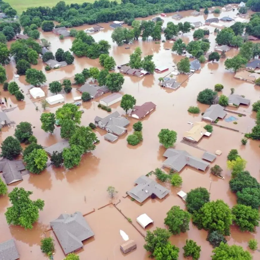
Flooding can occur due to heavy rainfall, rapid snowmelt, or a storm surge from a hurricane. Predicting floods involves studying weather patterns, rainfall forecasts, river levels, and soil saturation. Hydrologists use a combination of satellite data, weather reports, and river gauges to monitor water levels in rivers and lakes. When heavy rainfall is expected in an area, scientists can use hydrological models to estimate the likelihood of flooding.
Forecasting flash floods, which occur rapidly within hours of heavy rain, can be more difficult, but meteorologists use radar technology and real-time data to provide warnings. Riverine flooding, which is more gradual, can be predicted with greater accuracy, giving communities time to prepare for rising water levels.
Tornadoes
Tornadoes are violent rotating columns of air that form during severe thunderstorms. Predicting tornadoes is challenging because of their rapid formation and unpredictable nature. However, meteorologists can forecast the likelihood of tornado formation by studying the conditions that lead to these storms. Tornadoes often develop when warm, moist air collides with cold, dry air, creating instability in the atmosphere. By analyzing weather patterns, scientists can identify areas where these conditions are likely to occur.
Severe weather radar, such as Doppler radar, is essential for detecting tornadoes. This radar system can track wind patterns and detect rotation in the atmosphere, which is an early warning sign of a tornado. By using this data, meteorologists can issue warnings minutes before a tornado touches down, giving people time to seek shelter.
Tsunamis
Tsunamis are large ocean waves caused by underwater earthquakes, volcanic eruptions, or landslides. Scientists monitor seismic activity and ocean floor movements to detect potential tsunami events. When an earthquake occurs beneath the ocean, sensors placed on the ocean floor can measure the movement of the seafloor, triggering an alert system. This information is quickly transmitted to tsunami warning centers, which issue warnings to coastal communities if there is a risk of a tsunami.
The speed at which a tsunami travels allows for warnings to be issued, although the time available to evacuate depends on the distance from the epicenter. Tsunami warning systems are crucial in minimizing the impact of these devastating waves, providing time for evacuation and other safety measures.
While predicting natural disasters with complete accuracy remains a challenge, scientists have made remarkable progress in forecasting the timing, location, and severity of events such as earthquakes, hurricanes, volcanic eruptions, floods, tornadoes, and tsunamis. By using advanced technologies, such as satellite imagery, radar systems, and weather models, scientists can provide early warnings that help reduce the impact of disasters. As technology continues to improve, so too will our ability to predict and respond to natural disasters, ultimately saving lives and preserving communities.


